Living PNG
As a component of the Pacific Blue Carbon Project (PBCP), Living PNG has helped build analytical processing capacity that can assist Papua New Guinea (PNG) map its coastal blue carbon ecosystems using a combination of Earth observations and already-derived products (e.g. for mangroves).
Aims
Objectives
Outcomes
Living PNG outputs represent a contribution to monitoring, reporting and verifying (MRV) the status of national carbon stocks as part of their National Determined Contributions (NDCs) and Emission inventory obligations. The analytical capacity is delivered through the Australian Commonwealth Scientific and Industrial Research Organisation’s (CSIRO) Earth Analytics Science and Innovation (EASI) platform, which utilises the capacity of the Open Data Cube (ODC) to make available analysis ready data (ARD) from multiple Earth Observation data series. Included are relevant algorithms, scripts and user interfaces for the integration/refinement of existing mangrove maps and other blue carbon products into a broad land cover product generated using the Living Earth approach.
Our aims are:
To generate a classification of broad land covers and associated blue carbon ecosystems for Papua New Guinea’s coastal environments using the processing and analytical capability of the EASI datacube.
Tagline 1
Our objectives are:
Scope ability to retrieve or classify environmental descriptors (EDs) from Earth observation (EO) data (primarily spaceborne optical and radar) that can be used to map and detect change in blue carbon habitat extent and biomass including mangroves, saltmarsh, and, if possible, seagrass and supratidal forests.
Tagline 2
Planning for the future of coasts
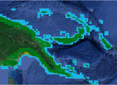
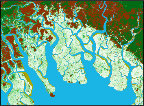
A national map of land cover for the coastal landscape of 16 provinces in Papua New Guinea based on the Food and Agriculture Organisation (FAO) Land Cover Classification System (LCCS) as implemented within Living Earth. The map encompasses the broad land cover classes of the FAO LCCS (e.g., bare and artificial surfaces and water and, natural terrestrial and aquatic vegetation), with further discrimination provided for the blue carbon ecosystems, namely mangroves (from the Global Mangrove Watch (LINK TO: https://www.globalmangrovewatch.org), suptra-tidal forests and other intertidal wetlands (LINK TO: https://www.globalintertidalchange.org/) and sea grasses. Estimates of the biomass (carbon) content of several ecosystems has been obtained using European Space Agency (ESA) Climate Change Initiative (CCI) Biomass data. The project has demonstrated the transferability of the Living Earth land cover mapping software to a new ODC instance (CSIRO’s EASI) and geographical setting as well as the classes mapped and algorithms used (e.g., for discriminating woody/non-woody vegetation). Training in the use of the Earthtrack mobile application has also resulted in new records from Papua New Guinea’s coastal ecosystems.
Tagline 3


