Interactive Map
Living Earth vision and mission and pathways to achievement.
Opensource Tools for earth scientists & policymakers
Interactive Map
Exploring Living Earth products
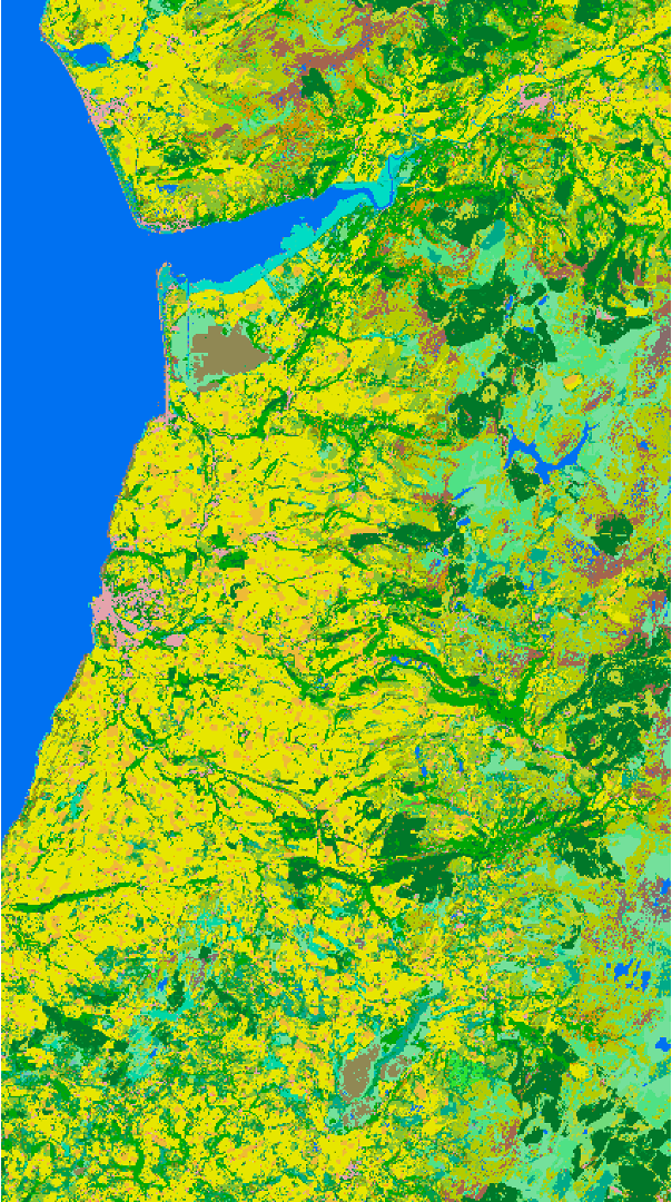
Using the Living Earth approach, maps of land cover have been generated for Wales, Australia and, more recently, the coastal zones of Papua New Guinea. The map interface for Wales is being upgraded to provide a new interactive map and whils this is being developed, please select Countries > Wales > TOOLS: See it on a Map to access the products from 2018-2023. Those for Australia are available by selecting Countries > Australia > TOOLS: See it on a Map.
These maps provide a platform for visualizing how people and nature have shaped the landscapes we see today. These maps have been obtained primarily from historical satellite data and are updated through near daily observations.
Living Earth layers are openly available and accessible for people to use but also to view current and historical changes in the national landscape over varying time periods and understand the reasons for these.
Initially, select the broad land cover as the base map, and then add layers that represent different categorical (e.g., crop type) or continuous (e.g., water persistence, above ground biomass) environmental descriptors to give more detail.
Maps for Wales
View maps of habitat extent (for Wales only), with these generated through direct translation of some classes (e.g., broadleaved forest) from the land cover map or by splitting mapped classes using contextual information (e.g., the extent of peatlands or coastal environments.
Free and open for everyone
All Living Earth layers are openly available and accessible for people to use but also to view current and historical changes in the national landscape over varying time periods and understand the reasons for these.
The uniqueness of Living Earth legends
The legends used for land cover and change are globally relevant as they are based on the Food and Agriculture Organisation (FAO) Land Cover Classification System (LCCS) and Living Earth’s Global Change Taxonomy. The taxonomies used for habitats maps (where existing) are specific to the country.
Free to use
The maps can be used for multiple purposes, including assessing past and current land management and use and impacts on carbon, biodiversity and soil, water and air quality. They can also inform local, national and international policy.
Publications
Refer to our publications page to learn about conceptual and practical development of Living Earth.